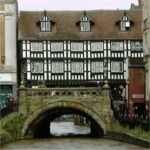
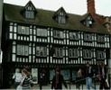
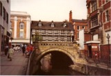
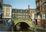
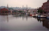
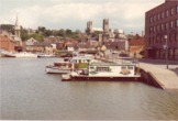
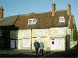
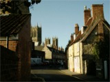
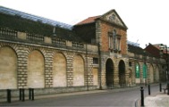
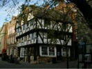
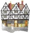
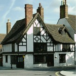
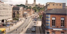
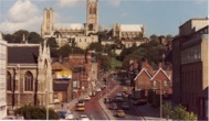
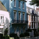
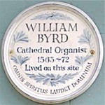
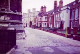
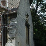
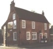
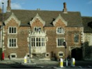
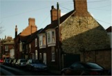
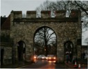
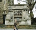
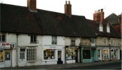
High Bridge (High Street). High Bridge, in the center of modern Lincoln, spans the River Witham. The Shops on High Bridge (207, 209-210 High Street) date from the 16th century, but the history of the bridge itself goes back to the 12th century, with additions in the 13th, 16th and 19th centuries. In June 1720, William Harrison and his wife, Ellen, commenced a 21 year lease of the house on High Bridge. The house formerly belonged to John Heath and later to Alderman John Copall (ref: L1/1/1/7, page 69).
The History of Lincoln Waites
Historic Buildings of Lincoln
These buildings and views are all familiar to the modern natives of Lincoln. Years ago, they would also have been familiar to men and boys of Lincoln City Waits. This page includes photographs that are not used elsewhere in this website.
Click a picture to enlarge. To return to this page, simply close the image window.
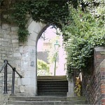
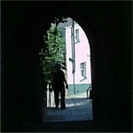
From the High Street, there are flights of steps on either side of the bridge that lead to the River Witham, and to where the Glory Hole can be seen. [A Glory Hole is the name often given to the underneath of a bridge.] High Bridge is believed to be the second oldest masonry arch bridge in the country.
This is one of only three bridges in England with shops on them, the others are Pulteney Bridge in Bath and Frome Bridge in Somerset.
The Glory Hole (access from High Street, Water Lane or Brayford Wharf North). The footpath linking the Brayford Pool to the High Street is used by hundreds of people every day. This path leads though a narrow passageway underneath the offices of Gilbert Blades, Solicitor. Traditionally, Lincoln people know this as The Glory Hole.
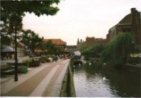
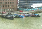
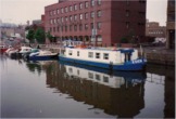
Whilst the River Brayford and its Pool could hardly be considered buildings, they have always been a feature of the working and commercial life of the citizens of Lincoln. Long after Lincoln lost most of its trade (as an inland port) to Boston, the Brayford Pool continued to be an industrial area, surrounded by mills and warehouses.
Chantry College, Minster Yard. This image is included with kind permission of Lincoln artist, Harry French.
Market Hall, Lincoln. Prior to being removed to it's present location, at the rear of the Cornhill Building, the old Buttermarket Pavillion used to stand in the Churchyard of St Peter at Arches. In 1785 the Bishop of Lincoln issued his Licence to the Corporation allowing them to take a part of the churchyard of St Peter at Arches, for the Buttermarket, paying the Vicar an annual ground rent of £6 per year. (L1/6/6/(a) The Accounts of Samuel Lyon, Town Clerk, 1785, page 49).
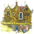
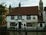
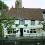
The Witch in the Wardrobe (21 Waterside) stands beside the river, between the Green Dragon and High Bridge.
The Witch in the Wardrobe (21 Waterside). This image is reproduced by kind permission of Lincoln artist, Harry French.
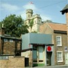
St. Swithin's Church (Free School Lane). St. Swithin Near Sheep Market was nearly destroyed by fire in 1644 and rebuilt in stone in 1801. It is built on the Sheep Square.
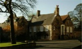
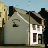
Swan Cottage stands just over the road from the Brayford Pool. Despite the sacrilegious pebble-dashing, the lines of the windows and roof suggest that this is a much older building than first glance reveals. Possibly even medieval.
The Parish Church of St. Mary le Wigford (High Street) was originally erected soon after the Norman Conquest by a citizen of Lincoln of Danish descent, named Colswegen. Wigford was once a village, outside of the City of Lincoln.
A Roman Gravestone is set into the base of the tower at St. Mary le Wigford. The Gravestone inscription reads: "Dis Manibus / nomini Sacri / Brusci fili(i) civis / Senoni et Carsso / unae coniugis / eius et Quinti f(ilii)" [To the gods of the dead/departed/underworld. For the name (family of) of Sacer, son of Bruscus, citizen of the Senones et Caessouna his wife and Quintus his son].
In the top section, this Saxon inscription has been added: "Eirtig me let wircean and fios godian Criste to lofe and sancte Marie XP" [Eirtig had me built and endowed to the glory of Christ and Saint Mary, XP]. Eirtig was benefactor who raised the funds to erect the Church.
The Parish Church of St. Mary le Wigford (High Street) was originally erected soon after the Norman Conquest by a citizen of Lincoln of Danish descent, named Colswegen. Wigford was once a village, outside of the City of Lincoln.
Quaker Meeting House (Beaumont Fee). This Meeting House was built in 1689, the same year that the Toleration Act was passed. It is built on a plot of land near the old pot market (Newland) and was the first licensed non-conformist place of worship in the City of Lincoln. The inside walls are made from straw and dung. Prior to 1689, non-conformists (dissenters) were not allowed a licensed place of worship and risked arrest if they met for services.
Between 1650 and 1689 many Quakers were imprisoned in Lincoln Castle and the City Gaol. In 1699 a plot of land was bought for £8 near the pot market in Newland for burying the Quaker prisoners who died. It was on the unused part of this plot that the Meeting House was built.
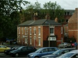
Three Stone Cottages (Motherby Lane). Possibly 18th or 19th century labourer's cottages. These dwellings are close to Beaumont Manor and its park (where City Hall stands now) and orchard (hence Orchard Street nearby).
Medieval House (5 Strait). The present owner has traced this house back to 1390. It appears that this building once stood alone, rather than in a terrace as it does today, because there is evidence of old doorways which once led out to the side.
Jews House and Jews Court
Jews House (15 Strait and 1 Steep Hill). This 12th century Jewish merchants' house dates back to 1158, making it the oldest domestic building in Britain. It has an highly ornamental doorway and chimney. The three original segmental arches [for shop fronts] were removed long ago and replaced by modern shop windows. In the Middle Ages, Lincoln had a flourishing Jewish community with moneylenders, traders and merchants. The people within this community were amongst the richest and most influential citizens of Lincoln.
Jew's House is said to be the former home of Belesat de Walingford, who was hanged for clipping coin.
Jews House and Jews Court
Jews Court (2 and 3 Steep Hill). Although there are stories of this building being a 12th century Synagogue, the current three-storey limestone building seems to date from the 17th or 18th century. From around 1800 it was divided into 4 tenements which were rented out individually. Jews Court narrowly escaped demolition in the 1920s, during slum clearance.
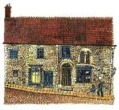
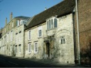
Harding House (51 Steep Hill). A 15th and 16th century building restored in 1962. Harding House has a stone built ground floor and a timber-framed first floor.
49 Steep Hill - currently "Omnipuss Art". A 15th or 16th century building with later additions and modifications. This building lies immediately north of Harding House. It is likely that the original construction was similar to its neighbour - a stone built ground floor and a timber-framed first floor. The ends, of what appear to be floor joists, can be seen in a horizontal line above the ground floor window. This could well be an indication that there was a jettied, timbered upper story at one time, but that was replaced with (possibly Georgian) brickwork long ago.
The Norman House (46-47 Steep Hill). This late 12th century stone house originally had shops on the ground floor and domestic quarters above and to the rear. Even though it has been much rebuilt, traces still remain of the front chimney stack, ornamental string-course and doorway. There is also a barrel vaulted undercroft facing south.
The Norman House is sometimes referred to as Aaron the Jew's House. This image is reproduced by kind permission of Lincoln artist, Harry French.
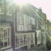
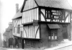
The Harlequin (21 and 22 Steep Hill). In 1744, soon after William Herbert's Company of Comedians started playing at Lincoln's first theatre (just round the corner in Drury Lane) the harlequin became the theatre Inn. This looks like a typical late 15th century timber-framed building, but some of the interior dates back to the 12th century. In July 1835, the Harlequin Public House, in the Parish of St Martin, was occupied by Frank and Charles Winn, and valued at £450.00 (L1/1/1/8, page 851). The Harlequin Inn was still trading in the 1930s. Today it is a bookshop.
Leigh-Pemberton House (8 Castle Hill and 1 Bailgate, ). A large timber framed merchant's house of 1543, extensively restored in the 20th century. It was a bank between 1899 and 1979. Sir Robert Leigh-Pemberton was chairman of the Nat West Bank and Governor of the Bank of England 1983-93.
Leigh-Pemberton House. This image is included with kind permission of Lincoln artist, Harry French.
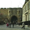
Exchequergate was built in 1350 and forms part of the Close Wall. The gatehouse is medieval with three arches and turrets and early brick and stone vaulting.
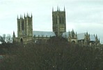
Lincoln Cathedral stands on the crown of the hill, some 200 feet above river level. The building of the Cathedral began in 1072 when William the Conqueror appointed Remigius, a Norman from Fécamp Abbey, to be the first Bishop of Lincoln. The cathedral once had three wooden spires, covered with lead. The spire on the central tower was blown down in 1549. Those on the two western towers were removed in 1808 for being unsafe.
Minster Yard, looking towards Exchequergate: Photographed by Reg Bennett (courtesy of Mr & Mrs A Bennett).
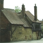
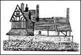
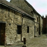
This Medieval Tithe Barn stands just a few hundred yards to the East of the Old Bishop's Palace. Near the top of Greestone Stairs.
The Black Boy Inn (at the Junction of Drury Lane and Castle Square). An ale-house certainly stood on this site in 1642 and possibly for hundreds of years before that. It occupies a prime site, between Castle and Cathedral, with the Judges Lodgings opposite. The earliest reference to the Black Boy Inn as such was in a lease dated 1745. Most of the current building seems to be no earlier than 18th Century but one early roof truss remains that could be 16th Century. When working in Lincoln, William Marwood, the Official Executioner, would stay at The Black Boy. In 1872, Marwood (a Cobbler from Horncastle, Lincolnshire (1820-1883)) introduced the 'Long Drop'.
Castle Cottage (Union Road). The roof, circular windows and gable-end upper window appear to be in the Edwardian style.
The Strugglers Inn (Westgate). I have heard two explanations of this Inn's name, both involving condemned men, I will leave you to decide which one you think is true. (1) Prisoners would struggle in an attempt to escape from their captors, whilst being taken to a place of execution. (2) Before the "Long Drop" was introduced, prisoners who were hanged had a long lingering death. As they slowly asphyxiated, their bodies would squirm and twitch and struggle on the end of the hangman's rope. The gibbet is supposed to have been nearby.
Old Militia Quarters (Mill Road). These houses stand on the opposite side of the road to Ellis Mill. Officers lived inside the Militia Barracks on Burton Road (now The Museum of Lincolnshire Life) but other ranks had quarters in Mill Road, to the rear of the Barracks. When they were first built (around 1857) the first floor of these houses were not divided, but instead, formed one long barrack room for the single men. The ground floors were divided up to accomodate married soldiers and their families.
Before the Barracks were built, soldiers were quartered in the City Inns and Public Houses, giving rise to many complaints from the people of the City and from the Inn Keepers (ref: L1/1/1/7, p696 (27 Mar 1786)).
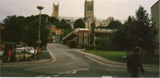
Drury Lane.
Left: The date stone on this house says "W.T. 1821".
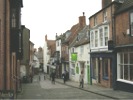
Right: Looking towards the Cathedral.
The Roman Trail. This is the boundary wall of Roman Lincoln. The original fortress boundary was extended south down what is now Motherby Hill and The Park, to City Hall (the old Orchard) then in an easterly direction past the Stonebow and along Saltergate, and north again at St Swithin's Church, up Broadgate.
Georgian Houses. Grafton House (left), Unison Offices on Orchard Street (centre) and Hilton House (right). Hilton House was owned by the brother-in-law of the painter Peter De Wint.
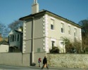
Hilton House (Union Road) was built around 1790. The house was purchased and enlarged in 1814 by William Hilton, whose fellow art student, and brother-in-law was the artist Peter de Wint. Peter De Wint (b.1784 - d.1849) was an English landscape painter, the son of a physician of Dutch ancestry, who had come to England from New York. His life was devoted to art and he ranks as one of the chief English watercolorists. A number of his pictures are in the National Gallery, the Victoria and Albert Museum and The Collection, Lincoln.
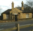
Toll Bar House, just across the road from Canwick Common. The date above the door is 1843. After the Enclosure Award of Canwick Parish, Canwick Common became Lincoln's South Common.
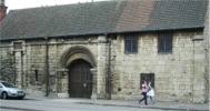
The Medieval St Mary's Guildhall is just a short walk away from the main shopping centre. It is a beautiful medieval building, housing a section of the Roman Fosse Way - on display through a glass floor. St Mary's Guildhall was completed in about 1160 and used first as a Royal Palace. All citizens of Lincoln were automatically members of The Guild of St Mary, and were thus charged a membership fee. The row of shops, opposite, occupy the site where John O'Gaunt, Earl of Lincoln, had his house.
St Mary's Guildhall was restored by Lincoln Civic Trust and houses their offices. Tel: 01522 546422.


